Historical Geographic Survey

Lenape village looking from where near Centre & Lafayette Streets intersection is now.
Structures are the artist’s imaginative rendition, based on upstate Iroquois long houses, while were actually wigwams most like the smallest illustrated.

Lenape villagers on the site that is now Federal Plaza, looking east towards fresh water pond.

Fresh water pond - top right
Lenape village - top left
CHP NE Plaza site including Co-naming pole - in field near center
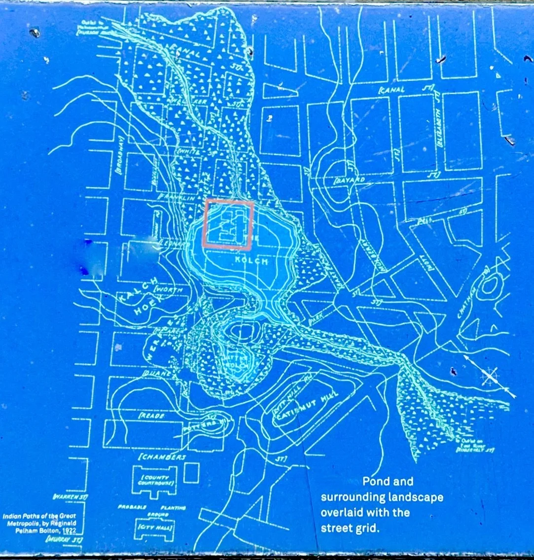
Overlay map of Lenape village Werpoes, ponds and nearby terrain with early 19th century street grid to City Hall, including CHP NE Plaza and proposed Street Co-naming site east of City Hall.

Lenape trails in Lower Manhattan before Dutch colonization were in a hilly forest, with fresh water ponds and streams, and innumerable Lenape villages throughout the thousands of years’ history, including Werpoes noted on the map.
CHP site is just south of the center of map where the trail kinks a little (where future Park Row merges with Broadway).

Lenapehoking
Lower Manhattan was central in Lenape Homeland as a crossroads for tribes travelling from all directions by land or boat.